James Dean Print from Galerie Prints
CA$410

You are now following British Wall Decor online at Pamono. You can manage alerts in your account settings.
You have unfollowed British Wall Decor online at Pamono.
James Dean Print from Galerie Prints
Katherine Hepburn Print from Galerie Prints

Woman Walking In Morocco by Bruno Barbier

Marilyn Monroe by Murray Garrett

Soft Helmets Print by John French

Mosquito Coast Boat Building by Alain Le Garsmeur

Pool On Amalfi Coast Print by Slim Aarons

Hotel Du Cap Poster by Slim Aarons

Gondolas in Venice Print from Galerie Prints

Florida Keys Print by H. Armstrong Roberts-Alamy

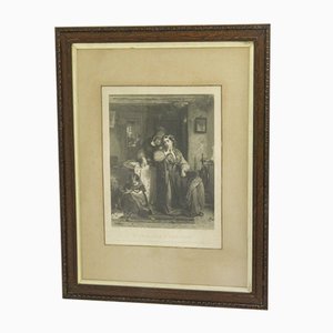
Victorian Engraving, 1874
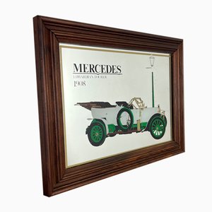
Automobile Car Sign
Vintage London Advertising Sign

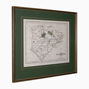
Lithography Map Monmouthshire Welsh Cartography

Royal Advertising Sign

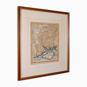
English Environs of Bath & Bristol Map

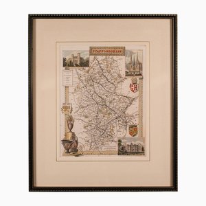
English County Map Staffordshire
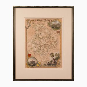
English Lithography Map Derbyshire

English Lithography Map Huntingdonshire
Large Opaline Glass Pub Signs Draught Beers, 1960s, Set of 2

Mid-Century Educational Chart Ants by Jung, Koch, & Quentell, 1974

Antique English Country Map

Antique English County Map, 1790

Antique English Framed Lithography County Map, 1860s

Antique English County Map Lithography

Dutch County Map of Cheshire by Janssonius, 1660s

English Collegiate Map, Cambridge, 1838

Georgian County Map Rutlandshire by John Cary
English Road Map Bristol to Weymouth

Antique English Georgian Framed Town Plan Map, 1780

Small English Country Map, Northamptonshire, 1850s

Coaching Road Map Cranborne to Dorchester

Large English Wimbledon Map SW London

Antique English Framed Cambridgeshire County Map by Robert Morden, Late 17th Century

Antique County Map by Robert Morden, 1700
St. Johns Wood Tube Station Roundel, 1940

Holborn Tube Station Roundel, 1950

Bank Tube Station Roundel, 1940

Leicester Square Tube Station Roundel, 1940

Antique County Map, Northamptonshire, English, Framed Cartography, Richard Blome

Antique Lithographic Map of Warwickshire

Lithography Map Hampshire, England, 1850s

Taiwan Map from Dutch East India Company, 1724

Large Antique Lithography Map of Kent, 1700

French Toleware Violin Makers Shop Trade Sign, 1950s

Victorian Lithographic Map with Environs of Southampton, England

Large Chart of Jamaica, 1753

17th Century Prospect of Lisbon

Large-Scale Survey of London Map with Marylebone & St Pancras

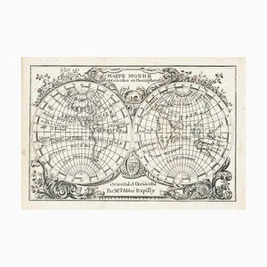
Miniature Double-Hemisphere World Map by J. Expilly, 1765
16th Century Miniature Map of Ischia by B. Langenes, 1599

Prospect of Munich, Early 18th Century

Advertising Garage Enamel Sign

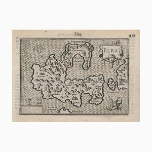
16th Century Miniature Map of Elba by B. Langenes, 1599
Mid-18th Century Map of Taiwan by Bellin, 1748

Allegorical Map of England

Map of Classical Arabia

Panorama of Stockholm

Panorama of Vienna Under Siege by the Ottomans

Unusual Balloon View of Brighton, 1840s

Caricature Map of Italy

17th Century Plan of Valletta

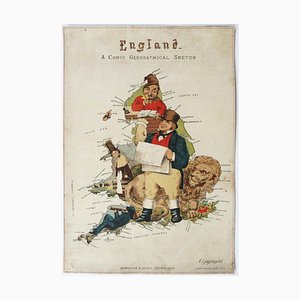
Caricature Map of England and Wales
The Route of the Spanish Armada Around the British Isles

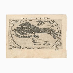
First Issue of Rosaccios Map of Venice
Napoleon in Exile on St Helena

16th Century Italian Map of Cambridge

17th Century French Map of Arabia

Maps of the World & Continents, Set of 7

A Birds-Eye View of Paris

Classic Carte-À-Figure Map of the Netherlands & Belgium

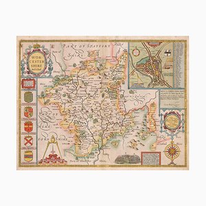
17th Century Map of Worcestershire, 1676
Ptolemaic Map of Italy

A 17th Century Engraving of the Zodiac Sign Leo

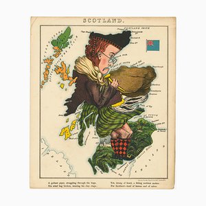
Satirical Map of Scotland
World Map as a Chocolatiers Competition, 1950s

16th Century Miniature Map of Cyprus

17th Century Map of Luxembourg

Map of the British Isles with Decorative Borders

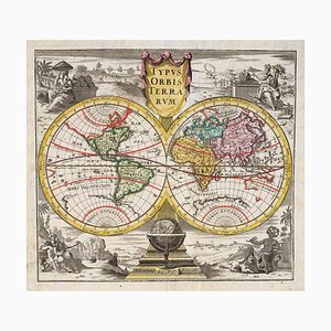
18th Century Double-Hemisphere World Map
Large and Detailed Chart of the Bahamas, 1700s

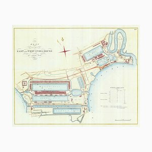
Detailed Plan of Londons Docklands
Wall Map of Europe Illustrated with Military Uniforms, 1890s

Pictorial Map of Russia

The City and Whitechapel from a Large-Scale Survey of London

Covent Garden and Soho from a Large-Scale Survey of London

Early 17th Century Map of Wales, 1619

Pimlico and Belgravia from an Important Large-Scale Survey of London

Plan to Redevelop the Corner of Park Lane and Piccadilly

Detailed Town Plan of Madrid

Map of North America During the Mississippi Bubble

Four-Sheet Wall Map of the Far East, Set of 4

17th Century Panelled Map of the Holy Land

A 17th Century Engraving of the Zodiac Sign Sagittarius

Caricature Map of Wales

18th Century Maritime Explanatory Print

Trending